
A Timelapse of Earth and Glaciers
Google Earth has a New Trick up its Sleeve
April 22, 2021
April 22nd 2021 is Earth day. This day commemorates the new movement of caring for the planet. Google Earth has a new feature and it’s a timelapse of the majority of Earth over the last 37 years.
Over the years issues such as climate change, pollution, and deforestation have been researched more and more. With each new discovery and the more information humanity has gained, the more humanity has realized how serious these issues are. The entire ecosystems, species, and the planet are on the line.
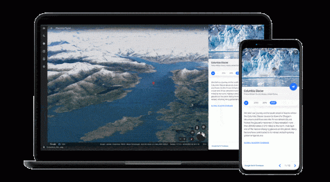
Using the power of satellite imagery people can see large changes in the environment over 37 years. These pictures have taken up over a petabyte of data. In other words that’s the average storage capacity of over 2,000 computers. The newest featured area is a timelapse on the melting of the Columbia Glacier in Alaska.
The point of this is not to stir up mass panic or fear in the public. However, it is likely to do so since it is the destruction of an ecosystem. It is meant to raise awareness of the growing issues of climate change affecting the planet.
It is important to help minimize contributing to climate change. Something on a planetary scale though is something that can only be conquered together.